EmergencyAPI
Real-Time Australian Emergency Data API
// the problem
Australia has 8 states and territories, each with their own emergency services publishing incident data in different formats, on different schedules, through different feeds. Developers building safety apps, insurers assessing risk, media tracking breaking news, and utilities monitoring infrastructure all have to wrangle 27+ separate government feeds just to get a unified picture.
// the solution
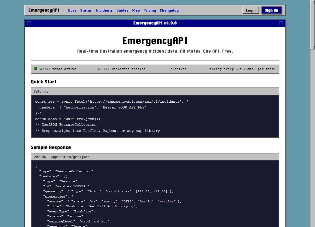
EmergencyAPI aggregates all 27 official government emergency feeds into a single, unified REST API. Every response is GeoJSON native, so it plugs straight into mapping libraries like Leaflet and Mapbox. The API covers bushfires, floods, storms, earthquakes, vehicle accidents, rescues, hazmat, and more, across every state and territory.
The free tier gives developers 500 requests per day with no credit card or approval required. Feeds are polled every 30 seconds to 15 minutes depending on the source, and the API follows the CAP-AU (Common Alerting Protocol Australian Profile) standard.
// live map
The [live emergency map](https://emergencyapi.com/map) shows all confirmed active incidents across Australia in real time, colour-coded by event type. It auto-refreshes every 30 seconds and supports filtering by state and incident type. Polygon overlays show affected areas where data is available.
// incident dashboard
The [incident dashboard](https://emergencyapi.com/incidents) provides a searchable, filterable list of every active incident. Filter by state, incident type, or severity. Each entry shows the location, status, type, and last update time.
// core features
// frequently asked questions
Is EmergencyAPI free to use?+
Yes. EmergencyAPI offers a free tier that gives every developer 500 requests per day with no credit card and no approval process required. Just grab an API key and start building.
Where does the data come from?+
EmergencyAPI aggregates 27 official government emergency feeds across all 8 Australian states and territories, plus national sources like Geoscience Australia for earthquake data. Sources include NSW RFS, QLD QFD, VIC EMV, SA CFS/MFS/SES, WA DFES, ACT ESA, TAS TFS, and NT PFES.
What types of incidents does EmergencyAPI cover?+
EmergencyAPI tracks bushfires, floods, storms, earthquakes, vehicle accidents, ambulance calls, hazmat, structure fires, grass fires, rescues, burn-offs, and other emergency incidents reported by official Australian state and federal services.
Is the response format GeoJSON?+
Yes. Every response is a valid GeoJSON FeatureCollection so it plugs straight into mapping libraries like Leaflet, Mapbox, OpenLayers, deck.gl, or any GeoJSON-compatible client.
Can I rely on EmergencyAPI for safety-critical decisions?+
No. EmergencyAPI surfaces public emergency data and may be delayed, incomplete, or inaccurate. Always defer to your state's official emergency services for safety-critical decisions.
How frequently is the data updated?+
Each feed is polled on its own schedule, between every 30 seconds and every 15 minutes depending on the source. The /v1/status endpoint reports the live age of each feed.
// tech stack
// from the sey solutions ecosystem